Profile
Abitibi Geophysics has over 30 years of experience in delivering solutions to geoscience challenges. We offer a complete range of geophysical services for surveying, data processing, exploration-targeted interpretation, geotechnical, engineering and environment. We acquire the latest geophysical technologies, and continually develop in-house methods and equipment to maximize the discovery of new targets at depth or that are undercover, from surface, in boreholes, and by drone.
We provide a total service package: survey design, data acquisition, compilation, project reporting, interpretation, modeling and inversion, and quality control. Our work is conducted efficiently, safely, and reliably. With the help of our partners, we offer our services and solutions worldwide. Our survey types are:
- Time-Domain Electromagnetics (ground and BH)
- Resistivity / Induced Polarization (ground and BH)
- Gravity (ground and BH)
- Ground Magnetics
- Drone Magnetics, LiDAR and photography/videography
- Radio Image Tomography
- Ground Penetrating Radar (GPR)
- Magnetotellurics (MT, AMT, and CSAMT)
- Acoustic Optical Televiewer
- Near-surface seismic
Continuous improvement and innovation in geophysical services make Abitibi Geophysics a proud partner in helping its clients explore more extensively and cost-effectively. Through innovation, the mining industry will make more discoveries to meet the global demand for minerals.
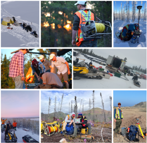
Surveying the data around the world.
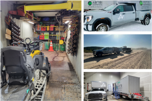
Abitibi Geophysics’ Portable Lab units are used to support field crews.

Our technical department enables Abitibi Geophysics to deliver efficiently in the field operation.
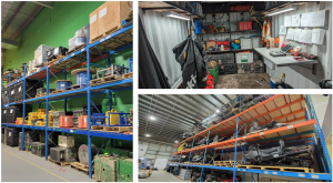
We have all the equipment needed to run up to 14 field crews.